
← Back to Blog
Neighborhoods
What Neighborhoods in Oak Ridge Tennessee Are Close to Walking Trails or Outdoor Recreation
By Amy Evans, 865-294-5848 Office
Realty One Group Anthem · License# 266320
September 26, 2026 · 11 min read
If you are asking what neighborhoods in Oak Ridge Tennessee are close to walking trails or outdoor recreation, the short answer is: most of them. Oak Ridge sits inside Anderson County, bordered by the Clinch River to the north and Melton Hill Lake to the south, and the city has built an unusually connected system of greenways, parks, and reservoir access points that puts outdoor recreation within a short walk or bike ride of many residential streets. This guide breaks down which areas of Oak Ridge put you closest to specific trails, water access, and green space, along with the housing stock and price ranges you can expect in each.
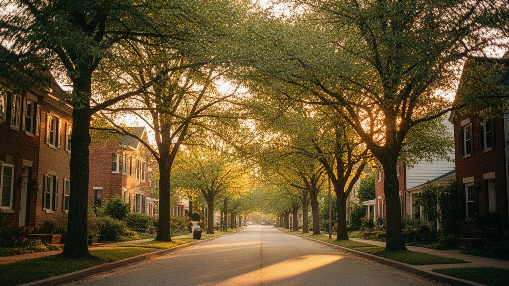
1. Why Oak Ridge Has So Much Trail and Park Access
Oak Ridge is unusually well-equipped for outdoor recreation given its population of roughly 32,000 people. The city's layout was originally planned by the federal government during the Manhattan Project era, which meant large buffers of undeveloped land were preserved around the residential zones. Decades later, those buffers became parks, greenways, and nature corridors that now connect neighborhoods in ways that most Tennessee cities of similar size simply do not have.
A City Designed Around Green Space
The city sits on the Cumberland Plateau foothills, so the terrain itself is varied: ridgelines, creek drainages, lake edges, and wooded slopes. That topography made it impractical to develop every parcel, which is a benefit for anyone who wants a home with trail access nearby. Oak Ridge's parks and recreation department maintains multiple trailheads, greenway segments, and lakeside parks that together form one of the more cohesive outdoor networks in East Tennessee.
The Greenway Network at a Glance
The Oak Ridge Greenway is a paved multi-use path that currently stretches approximately 14 miles through the city, running through residential areas, past parks, and connecting to several trailheads. The National Park Service recognizes the Oak Ridge greenway system as a local trail resource worth exploring; you can find an overview of the network on the National Park Service's Oak Ridge greenways page. The paved greenway is separate from the natural-surface trail systems like Haw Ridge, which means Oak Ridge actually offers two distinct outdoor experiences: smooth paved paths for cycling and jogging, and rugged singletrack for mountain biking and hiking.
2. Neighborhoods Near the Oak Ridge Greenway System
Several Oak Ridge neighborhoods sit directly adjacent to the greenway corridor or within a short walk of a trailhead. The specific neighborhood you choose determines which segment of the greenway you can access on foot, how much elevation change you encounter, and whether you are closer to the lake end or the forested interior sections of the trail system.
West Oak Ridge and the Wheat Community Area
The western sections of Oak Ridge, including the Wheat community area near Illinois Avenue and the neighborhoods that stretch toward the Clinch River arm of Melton Hill Lake, sit close to greenway access points and open space buffers. Homes in this part of the city tend to be a mix of mid-century ranch styles built during the 1950s and 1960s, alongside some newer infill construction on larger lots. Square footage typically runs from about 1,100 to 2,200 square feet, and as of September 2026 you can find homes in this corridor priced from the low $200,000s up to the mid $300,000s depending on lot size and condition.
The Wheat area in particular has direct proximity to the greenway's western segments and is a short drive or bike ride from Solway Park, which sits at the western edge of Oak Ridge along the Clinch River. The streets here are quieter, with wider lots than you find closer to downtown Oak Ridge, and several properties back up to wooded buffers that connect visually to the surrounding green space.
South Hills and the Haw Ridge Corridor
South Hills is one of the Oak Ridge neighborhoods with the most direct access to Haw Ridge Park, which contains over 35 miles of natural-surface trails. The neighborhood sits on elevated terrain south of Illinois Avenue, and some streets in South Hills are within a half-mile walk of Haw Ridge trailheads. The housing stock here leans toward split-levels, brick ranches, and two-story colonials built primarily from the 1960s through the 1980s, with lot sizes that often run a quarter-acre or more. Prices in South Hills as of September 2026 generally fall between the high $200,000s and the mid $400,000s, with updated homes on larger lots commanding the higher end of that range.
The elevation in South Hills also means some properties have ridge views toward the surrounding Anderson County terrain. The greenway's paved path runs through portions of this zone as well, so residents have access to both the paved multi-use trail and the natural-surface Haw Ridge system without needing to drive to a trailhead.
Woodland and the Central Greenway Connector
The Woodland neighborhood occupies the central section of Oak Ridge, roughly between the Oak Ridge Turnpike commercial corridor and the forested land to the south. The greenway's central spine runs through or adjacent to this area, making it one of the more walkable neighborhoods in the city for anyone who wants to commute on foot or by bike to Bissell Park or the Melton Lake area. Homes here include a mix of 1950s Cape Cods, brick ranches, and some larger two-story homes, with prices that currently range from the $180,000s to the low $300,000s.
Woodland's central location also means it is close to the Jefferson neighborhood, which has its own distinct character and housing market. If you want a deeper look at that specific area, the Jefferson neighborhood real estate guide covers pricing, timing, and what to expect when buying there.
3. Neighborhoods with Direct Lake and River Access
Oak Ridge borders two significant bodies of water: Melton Hill Lake to the south and the Clinch River to the north and west. Neighborhoods near these waterways offer outdoor recreation of a different kind: kayaking, fishing, paddleboarding, and shoreline walking rather than trail hiking. The distinction matters when you are choosing where to buy, because waterfront access and trail access are not always the same thing in Oak Ridge.
Melton Hill Lake Shoreline Areas
The neighborhoods along the southern edge of Oak Ridge, particularly those near Melton Lake Drive and the streets that feed down toward the TVA reservoir, put residents within a short distance of Melton Lake Park. That park includes a paved greenway segment along the shoreline, boat ramps, a rowing and paddling facility used by competitive teams, and open lawn areas. The Tennessee Rowing Center operates out of this area, and the calm water on Melton Hill Lake makes it one of the better flatwater paddling venues in the region.
Homes in the Melton Lake Drive corridor range from modest 1960s ranches to newer custom builds on larger lots with lake views. Prices vary widely: a renovated ranch without water frontage might sell in the $250,000 to $320,000 range, while a home with actual lake frontage or a dock easement can push well above $500,000 as of September 2026. Inventory in the lakefront segment is limited, so these properties move quickly when they appear.
Clinch River Proximity in the Northern Sections
The northern edge of Oak Ridge, where the city boundary approaches the Clinch River, includes areas near Solway Park and the western portions of the city that border Anderson County's rural land. Solway Park sits at the confluence of the Clinch River arm and the main lake body, and it offers fishing access, a boat launch, and open shoreline. Neighborhoods in this zone tend to have larger lot sizes and older housing stock, with more of a rural buffer feel than the central Oak Ridge neighborhoods.
4. Parks, Trailheads, and What They Connect To
Understanding which parks anchor the trail system helps you choose a neighborhood with the right kind of access for what you actually want to do outdoors. Oak Ridge's parks range from small neighborhood green spaces to significant natural areas with miles of maintained trails. The three most relevant to buyers focused on outdoor recreation are Haw Ridge Park, A.K. Bissell Park, and Melton Lake Park.
Haw Ridge Park: The Crown Jewel Trail System
Haw Ridge Park is a 900-plus-acre natural area on a peninsula that juts into Melton Hill Lake, and it contains over 35 miles of natural-surface trails designated for hiking, mountain biking, and trail running. The terrain is genuinely varied: some sections are flat and wooded, others climb the ridge for views of the lake below. The park has multiple trailheads, with the primary access point off Edgemoor Road. Neighborhoods like South Hills and portions of the western Oak Ridge residential areas sit closest to these entry points.
Haw Ridge is managed as a public natural area, and trail conditions are generally well-maintained. The mountain biking community in Oak Ridge has invested significantly in trail building here, so the singletrack is more developed than what you find at most municipal parks of comparable size in Tennessee.
A.K. Bissell Park and the Greenway Spine
A.K. Bissell Park sits near the center of Oak Ridge and serves as one of the main anchor points of the paved greenway system. The park includes open athletic fields, a disc golf course, picnic shelters, and direct greenway connections that allow residents to reach other parts of the city on the paved path without crossing major roads. Neighborhoods in the Woodland and central Oak Ridge zones are within a reasonable walk of Bissell Park.
For a broader look at Oak Ridge's parks and what each one offers, the Access Oak Ridge parks directory lists facilities, locations, and amenities across the city's park system in one place.
Melton Lake Park and Paddle Sports Access
Melton Lake Park runs along the southern shoreline and connects to the paved greenway, making it accessible both by foot from nearby neighborhoods and by car from trailhead parking. The park is particularly popular for flatwater kayaking and canoeing because Melton Hill Lake is a TVA reservoir with relatively calm water compared to larger Tennessee lakes. The rowing facility here hosts regional competitions, and the shoreline path is paved and well-lit for a stretch that makes it usable in the early morning and evening hours.
5. What to Know About Housing Near Oak Ridge Trails
Proximity to trails and parks in Oak Ridge does carry a measurable effect on home prices, but it is not uniform across every neighborhood. Understanding how the market prices trail access versus lake access versus greenway access helps you set realistic expectations before you start making offers.
Price Ranges and Housing Stock by Area
As of September 2026, the Oak Ridge housing market reflects the following approximate ranges by area type. Homes in the central Woodland and Robertsville corridor near the greenway spine typically sell between $180,000 and $310,000. South Hills homes near Haw Ridge access run from the high $200,000s to the mid $400,000s. Properties near Melton Lake Drive without water frontage fall in the $240,000 to $350,000 range, while true lakefront parcels start around $450,000 and can exceed $700,000 for updated homes with dock access. Western Oak Ridge near the Wheat area and Clinch River buffer lands generally prices between $190,000 and $330,000.
For a current read on what the broader Oak Ridge market is doing right now, the September 2026 Oak Ridge home prices guide breaks down median prices, days on market, and inventory levels across the city.
What Buyers Often Overlook When Searching Near Trails
Many buyers searching for trail-adjacent homes focus on the distance to a trailhead but overlook the practical details that affect daily use. In Oak Ridge, several things are worth verifying before you commit to a specific address. First, check whether the greenway segment nearest to a home is paved or unpaved, because the surface type determines whether it is usable for cycling, strollers, or wheelchair access. Second, confirm whether the nearest trailhead has parking if you plan to have guests join you for hikes. Third, look at the lot's relationship to the greenway: some homes in Oak Ridge back directly onto the greenway corridor, which provides immediate access but also means foot traffic passes behind the property.
The age of Oak Ridge's housing stock is also worth understanding. Most of the homes closest to the original greenway and park corridors were built between the late 1940s and the 1980s. That means buyers should budget for potential updates to electrical panels, plumbing, and HVAC systems even on homes that have been cosmetically renovated. A pre-purchase inspection from a licensed Tennessee home inspector is essential in this market.
If you are relocating to Oak Ridge from outside the area and want a full picture of the city before deciding where to focus your search, the relocation guide for Oak Ridge covers the broader landscape of neighborhoods, commute options, and what to expect during the buying process.
Oak Ridge is also an unusually short commute to Knoxville, which matters if you want outdoor access in Oak Ridge but need to work in the Knoxville metro. The drive along Highway 62 or Interstate 40 typically runs 25 to 35 minutes depending on your destination in Knoxville. For a detailed breakdown of that commute, the Oak Ridge to Knoxville commute guide covers typical travel times, traffic patterns, and route options.
FAQ
Which Oak Ridge neighborhood is closest to Haw Ridge Park trails?
South Hills is the Oak Ridge neighborhood with the most direct proximity to Haw Ridge Park, which contains over 35 miles of natural-surface hiking and mountain biking trails on a peninsula jutting into Melton Hill Lake. Some streets in South Hills sit within a half-mile of Haw Ridge trailheads off Edgemoor Road. The neighborhood features brick ranches, split-levels, and two-story homes primarily built from the 1960s through the 1980s, with prices as of September 2026 generally ranging from the high $200,000s to the mid $400,000s. Western Oak Ridge neighborhoods near the Wheat area also provide reasonable driving or cycling access to Haw Ridge's secondary trailheads.
Does Oak Ridge Tennessee have a paved greenway for walking and cycling?
Yes. The Oak Ridge Greenway is a paved multi-use path that runs approximately 14 miles through the city, connecting residential neighborhoods to parks including A.K. Bissell Park and Melton Lake Park along the southern shoreline. The path is separate from the natural-surface trail system at Haw Ridge, so Oak Ridge effectively offers two distinct outdoor networks. The National Park Service recognizes the Oak Ridge greenways as a notable local trail resource. Neighborhoods in the Woodland area and along the Melton Lake Drive corridor sit closest to the paved greenway's central and southern segments.
Are homes near Oak Ridge trails and parks priced higher than the rest of the city?
Trail and park proximity does influence pricing in Oak Ridge, but the effect varies depending on the type of access. Lakefront homes on Melton Hill Lake command the largest premium, with true waterfront properties starting around $450,000 and going well above $700,000 for updated homes with dock access as of September 2026. Homes near the Haw Ridge trailhead corridor in South Hills run from the high $200,000s to the mid $400,000s. Greenway-adjacent homes in the Woodland and central Oak Ridge areas are generally more affordable, often falling between $180,000 and $310,000. The oldest housing stock in the city tends to sit closest to the original park corridors, so buyers should account for potential renovation costs even when a home is priced at the lower end of the range.