
← Back to Blog
Neighborhoods
Andover Massachusetts Neighborhoods: What Each Is Like
By Jen Mason
Coldwell Banker Realty
September 7, 2026 · 11 min read
Andover, Massachusetts is not one single neighborhood, it is a collection of distinct pockets, each with its own housing stock, price range, commute profile, and feel. If you are trying to figure out which part of Andover fits your life, this guide breaks down what the different neighborhoods in Andover Massachusetts are actually like, with real numbers and local details so you can make a genuinely informed decision.
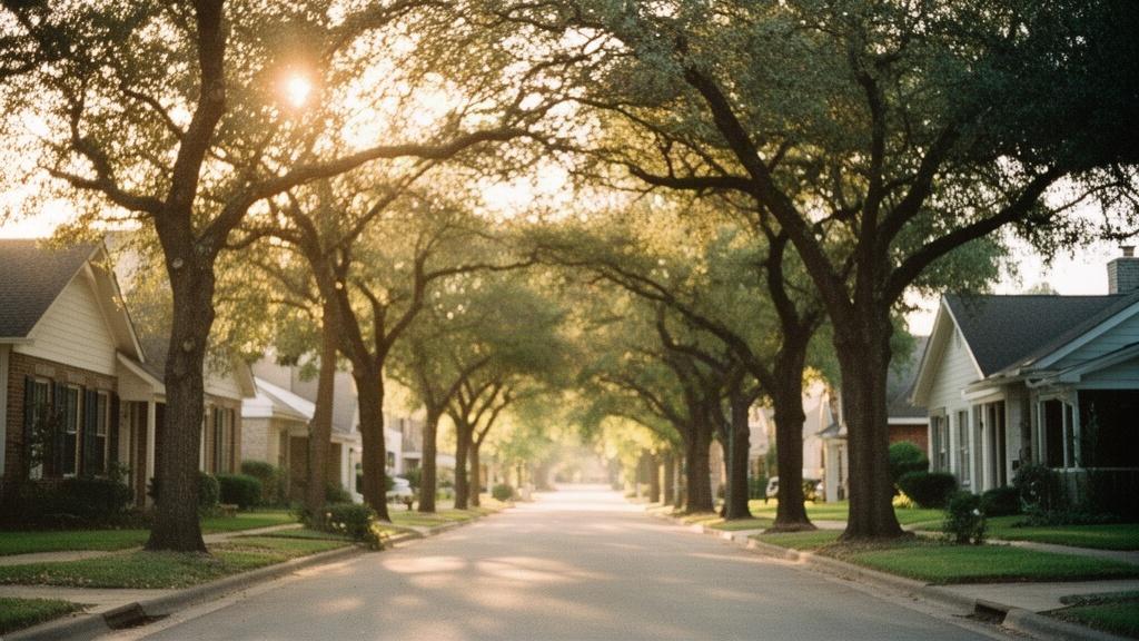
1. Understanding How Andover Is Laid Out
Andover covers roughly 33 square miles in Essex County, about 25 miles north of Boston along Interstate 93. It is not an urban grid. The town spreads across a mix of dense historic streets near the center, established suburban subdivisions from the 1960s through 1990s, and stretches of conservation land and open space that push toward the Merrimack River to the north and the Harold Parker State Forest to the west.
A Town of 33 Square Miles
Because Andover is large for a Massachusetts town, the experience of living here varies considerably depending on where exactly you land. The town's population sits at roughly 36,000 residents. Most of the denser housing clusters within a mile or two of the Town Center on Main Street, while the outer reaches of town thin out into wooded cul-de-sacs and rural roads with half-acre to multi-acre lots.
How the Merrimack River and Route 28 Shape the Map
Route 28 (North Main Street and South Main Street) is the town's primary spine, running north to south through the center. Interstate 93 cuts through the eastern side of town, making that corridor particularly convenient for commuters heading to Boston or Lawrence. The MBTA commuter rail Haverhill Line stops at Andover Station on Railroad Street, putting South Station in Boston roughly 50 to 55 minutes away by train. These transit facts matter a great deal when you are choosing between neighborhoods, because the closer you are to the rail station or I-93, the shorter your commute tends to be.
2. Town Center and the Historic Core
The Town Center neighborhood is the most walkable part of Andover Massachusetts. It surrounds the Main Street corridor from Elm Street down through the Phillips Academy campus and extends into the side streets radiating off Central Street and Punchard Avenue. If you want to walk to the farmers market, the post office, or a restaurant without getting in a car, this is the part of Andover where that is realistic.
Housing Stock and Architecture
The housing stock in the Town Center area is older and more varied than anywhere else in Andover. You will find Greek Revival and Federal-style homes from the 1800s alongside Victorian-era Colonials, early 20th-century Craftsman bungalows, and a handful of converted multi-family buildings. Lot sizes are smaller here, typically 6,000 to 12,000 square feet, and the homes sit closer to the street. Many properties retain original details like wide-plank floors, original millwork, and brick chimneys.
Price Range and Market Activity
In September 2026, single-family homes within a half-mile of Andover Town Center are generally priced from the high $600,000s into the $1.1 million range, depending on size, condition, and how recently they were updated. Smaller Cape Cods and older Colonials on the lower end of that range tend to move quickly. Larger, fully renovated homes on the tree-lined streets off Central Street or Chestnut Street can push closer to $1.3 or $1.4 million. Inventory in this pocket of town is typically thin because turnover is low; homeowners here tend to stay a long time.
Walkability and Daily Life
The Town Center puts you within walking distance of Andover's Memorial Hall Library, Punchard Avenue restaurants, the weekly farmers market on the Town Common, and the Andover commuter rail station. Phillips Academy, one of the country's oldest independent secondary schools, occupies a large portion of land adjacent to the center and contributes to the historic streetscape. The school's grounds are open to the public for walking and include the Addison Gallery of American Art, which is free and open year-round.
3. South Andover
South Andover refers broadly to the residential areas south of the Town Center, stretching toward the Reading and Wilmington town lines along routes like South Main Street, Lowell Street, and River Road. This part of Andover Massachusetts is characterized by larger lots, more subdivision-style development from the 1970s through 2000s, and a quieter, more spread-out feel compared to the historic core.
Lot Sizes and Housing Character
Lots in South Andover commonly range from a half-acre to two acres, and the housing is predominantly Colonial, split-level, and raised ranch styles built between 1965 and 1995. You also find newer construction pockets, particularly off Lowell Street and along some of the cul-de-sacs near the Shawsheen River. Garages are nearly universal here, and most homes have full basements. The scale of the homes is generally larger than in the Town Center, with many properties offering four or five bedrooms.
Commute and Connectivity
The further south you go in Andover, the more car-dependent daily life becomes. The commuter rail station is roughly a 10 to 15 minute drive from the southern parts of town. Interstate 93 is accessible via Exit 41 (Dascomb Road) or Exit 42 (Lowell Street), which puts you on the highway quickly for a drive to Boston in roughly 35 to 45 minutes depending on traffic. Route 28 south also connects to I-495, which opens up the MetroWest corridor.
Price Range in South Andover
In September 2026, South Andover homes are generally priced from the mid-$600,000s for older split-levels and ranches up to $1.2 million or more for larger newer Colonials on generous lots. The price-per-square-foot tends to be slightly lower here than in the Town Center because buyers get more square footage and land for their dollar. For buyers who want more space and are comfortable driving to the train or highway, South Andover often delivers strong value relative to other parts of town.
4. East Andover
East Andover sits between the Town Center and Interstate 93, making it one of the most accessible parts of Andover for commuters. The area includes streets off Dascomb Road, Lowell Junction Road, and the neighborhoods near the Ballardvale Village area along the Shawsheen River. Ballardvale itself is a recognized historic village within Andover, with a small cluster of 19th-century mill-era buildings along Clark Road and Andover Street.
What Makes East Andover Distinct
Ballardvale Village is a notable draw within East Andover. The village has its own commuter rail stop on the Haverhill Line (Ballardvale Station), which puts Boston's South Station about 50 minutes away by train. The area has a compact, walkable character around the station with some local businesses and the Shawsheen River running alongside it. Conservation land borders much of East Andover, including portions of the Andover Village Improvement Society (AVIS) trail network, which maintains over 30 miles of trails across Andover.
For more on the East Andover area specifically, the East Andover Neighborhood Guide on Homes.com provides a useful overview of the area's character and housing landscape.
Housing and Prices in East Andover
East Andover offers a mix of older New England-style homes near Ballardvale and mid-century Colonials and ranches further out toward Dascomb Road. Prices in this part of Andover Massachusetts tend to run from the high $500,000s to the mid-$900,000s for single-family homes, making it one of the more accessible entry points into Andover's market. Proximity to I-93 at Exit 41 is a real advantage: you can be on the highway in under five minutes from most East Andover addresses.
5. North Andover Border Areas and West Andover
The northern and western portions of Andover are the most rural in character. As you move toward the North Andover town line along Osgood Street and Greenwood Road, and westward toward Harold Parker State Forest along Reservation Road and Jenkins Road, the density drops off sharply. These are the parts of town where a two-acre lot is common and neighbors are not visible from the front porch.
West Andover: Larger Lots and Quieter Streets
West Andover borders Harold Parker State Forest, a 3,000-acre Massachusetts state forest with hiking, mountain biking, fishing ponds, and camping. Homes here are typically set on lots of one to five acres, and the housing styles skew toward custom-built Colonials and contemporary homes from the 1980s and 1990s. Some properties back directly to conservation land, which means no rear neighbors and a quiet buffer that is unlikely to change. The tradeoff is that everything requires a car: the commuter rail, grocery stores, and the Town Center are all 15 to 25 minutes away by road.
Prices in West Andover reflect the land and privacy premium. Single-family homes in this corridor in September 2026 are generally priced from the high $700,000s to well over $1.5 million for larger custom homes on multi-acre parcels. Buyers who prioritize space, privacy, and access to outdoor recreation often find West Andover compelling even with the longer commute.
The North Andover Boundary Zone
The northern edge of Andover, along Osgood Street and Marland Street, blurs into North Andover geographically. Homes here are on the Andover side of the town line but share the rural character of that corridor. Lot sizes are generous, and the housing stock is a mix of older farmhouse-style homes and newer construction from the 2000s. Route 125 connects this area to the Town Center in about 15 minutes and to Lawrence in about 10 minutes.
6. Comparing Andover Neighborhoods Side by Side
Each part of Andover Massachusetts has a distinct combination of housing type, price range, lot size, and commute profile. Here is a plain-language summary to help you compare them.
Town Center: Older historic homes, smaller lots (6,000 to 12,000 sq ft), walkable to rail and shops, prices from the high $600,000s to $1.4 million, low inventory and slow turnover.
South Andover: Suburban Colonials and ranches from the 1970s to 2000s, half-acre to two-acre lots, car-dependent, quick access to I-93 at Exits 41 and 42, prices from the mid-$600,000s to $1.2 million.
East Andover and Ballardvale: Mix of historic mill-era homes near the village and mid-century suburban homes further out, two commuter rail stops (Andover and Ballardvale), strong highway access, prices from the high $500,000s to mid-$900,000s.
West Andover: Custom homes and larger Colonials on one to five-acre lots, borders Harold Parker State Forest, fully car-dependent, prices from the high $700,000s to over $1.5 million.
North Andover border area: Rural character, farmhouse-style and newer construction, generous lots, 15 minutes to Town Center by Route 125, prices vary widely based on lot size and home age.
For a broader look at how these neighborhoods map out across the town, Homes.com's Andover neighborhood search lets you browse listings by area and get a geographic sense of how the different parts of town relate to each other.
If you are still working through the broader question of what it takes to buy in Andover right now, the 2026 Homes for Sale in Andover, MA guide covers the buying process, current inventory levels, and what to expect when making an offer in this market.
7. What to Know Before You Choose a Neighborhood in Andover
Choosing between Andover's neighborhoods comes down to a few practical trade-offs. The closer you are to the Town Center, the more walkable your daily life and the shorter your train commute, but the smaller your lot and the older your home. The further out you go, the more land and space you get, but the more dependent on a car you become.
Schools: Do Your Own Research
All of Andover's public schools fall within the Andover Public Schools district, and school assignment is based on your home address. For detailed information on which school serves a specific address, what programs are offered, and performance data, the best resource is the Andover Public Schools district website directly at andoverma.gov, as well as the Massachusetts Department of Elementary and Secondary Education at doe.mass.edu. These are personal decisions and worth researching thoroughly based on your household's specific needs.
Conservation Land and Trails
One of Andover's most distinctive physical features is the sheer amount of protected open space woven through the town. AVIS (Andover Village Improvement Society) maintains over 30 miles of trails on more than 8,000 acres of conservation land. These trails connect across multiple neighborhoods, meaning that in many parts of Andover, a trailhead is within a short walk or drive of your front door regardless of which neighborhood you choose. Harold Parker State Forest adds another 3,000 acres on the western edge.
Commute Options by Neighborhood
Andover Station on Railroad Street serves the Town Center and East Andover most directly, with trains to Boston's North Station (via the Haverhill Line) running roughly every 30 to 60 minutes during peak hours. Ballardvale Station on Clark Road is a second stop within town, serving the Ballardvale Village area of East Andover. For drivers, I-93 is the main artery, with Andover exits at 41 and 42 providing access from the eastern and southern parts of town. Route 125 and Route 28 serve the northern and central corridors.
FAQ
What is the most walkable neighborhood in Andover Massachusetts?
The Town Center area, centered on Main Street and the streets radiating off Central Street and Punchard Avenue, is the most walkable part of Andover. From this neighborhood you can reach the commuter rail station, Memorial Hall Library, the Town Common, and a range of restaurants and shops on foot. The tradeoff is that homes here are older, lots are smaller (typically 6,000 to 12,000 square feet), and prices in September 2026 generally run from the high $600,000s into the low $1 millions. Inventory in this pocket is consistently limited because turnover is low.
Which part of Andover MA has the largest lots and most land?
West Andover and the northern border areas near North Andover offer the largest lots in town, commonly ranging from one to five acres. West Andover borders Harold Parker State Forest and has many properties that back directly to conservation land. Custom-built Colonials and contemporary homes from the 1980s and 1990s are typical here, and prices in September 2026 run from the high $700,000s to well over $1.5 million for larger homes on multi-acre parcels. This part of Andover is fully car-dependent, with the Town Center and commuter rail 15 to 25 minutes away by road.
Does Andover Massachusetts have more than one commuter rail stop?
Yes, Andover has two commuter rail stops on the MBTA Haverhill Line. Andover Station on Railroad Street serves the Town Center and is within walking distance of the historic core of town. Ballardvale Station on Clark Road serves the Ballardvale Village area within East Andover. Both stations put Boston's South Station approximately 50 to 55 minutes away by train. Having two stations within the same town is relatively uncommon in the Boston suburbs and gives buyers in East Andover and the Town Center particularly strong rail commute options.