
← Back to Blog
Neighborhoods
What Neighborhoods and Areas Exist Within McKinleyville and What Is Each One Like to Live In
By Shelby Huddleson, Real Estate Professional
REMAX Humboldt Realty · DRE# 02165033
September 25, 2026 · 12 min read
McKinleyville, California is not a single uniform town; it is a collection of distinct pockets, each with its own housing stock, street layout, proximity to the coast or the forest, and price range. If you are trying to figure out what neighborhoods and areas exist within McKinleyville and what each one is like to live in, this guide breaks it down clearly, with real details about lot sizes, architectural styles, commute distances, and what you will find nearby.
1. How McKinleyville Is Laid Out and Why It Matters for Buyers
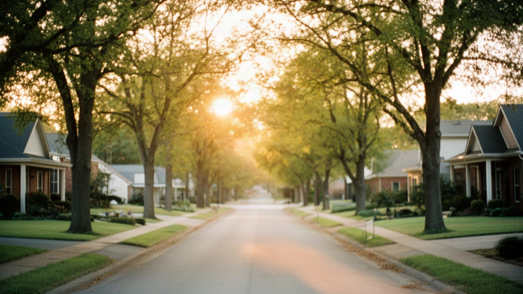
McKinleyville sits in northern Humboldt County, stretching roughly from the Pacific coastline eastward past Highway 101 toward the forested hills. The town does not have formally named, officially designated neighborhoods the way a larger city might. Instead, locals and real estate professionals refer to areas by their general location, the road they cluster around, or the era in which they were built. Understanding this geography before you start looking at homes will save you a lot of time.
The town covers approximately 26 square miles, which is large for a community of around 17,000 residents. That spread means the difference between a home on the west side near the bluffs and a home on the east side past the highway can be meaningful in terms of weather, lot character, and how far you drive to reach a grocery store or get on the freeway.
The Central Core and Central Avenue Corridor
Central Avenue is the commercial spine of McKinleyville. Along it and on the residential streets radiating off it, you find the town center: the shopping center anchored by a Safeway, local restaurants, the post office, and a mix of services. Homes within a few blocks of Central Avenue tend to be on smaller lots, often between 5,000 and 7,500 square feet, with a mix of 1960s and 1970s ranch-style construction alongside some older cottages.
What the Street Grid Tells You About the Housing
McKinleyville grew in waves from the mid-20th century onward, and that history shows up in the housing. Streets laid out in the 1950s and 1960s tend to have modest single-story homes with attached garages, original hardwood or vinyl flooring, and mature landscaping. Streets developed from the 1990s onward tend to have larger homes, two-car garages, and more formal subdivision layouts with cul-de-sacs. Knowing which era a street belongs to helps set expectations about square footage, maintenance needs, and what updates you are likely to find.
2. The Distinct Neighborhoods and Areas Within McKinleyville
McKinleyville contains several recognizable pockets that buyers and sellers consistently reference. Each has a different feel based on its proximity to the coast, the highway, or the commercial core.
The Westside and Coastal Bluff Area
The western edge of McKinleyville runs along coastal bluffs above the Pacific, accessible via Scenic Drive and the streets feeding off it. This area includes some of the most visually distinctive properties in town: homes perched above the ocean with views of the coastline, the mouth of the Mad River to the south, and on clear days, the outline of the North Spit. Lot sizes here vary considerably, with some parcels running larger than a quarter acre.
The housing stock on the west side is a mix of mid-century ranches, some with original picture windows facing the ocean, and more recent construction that maximizes the views. Buyers should be aware that coastal proximity brings consistent wind and salt air, which affects exterior maintenance timelines for paint, siding, and roofing. Homes here can command a premium over comparable inland properties, and they tend to hold interest from buyers who want that coastal character without living in a beach town with tourist traffic.
The Hammond Trail, a paved multi-use path running along the coastal bluffs, is directly accessible from this part of town. The trail connects to Mad River Beach County Park to the south and continues north toward the Clam Beach area, giving residents walkable access to miles of coastal path without getting in a car.
The Murray Road and Airport Area
Murray Road runs east-west through the middle of McKinleyville and defines a broad residential band north and south of it. This corridor sits closer to Highway 101 and to the Arcata-Eureka Airport, which is located at the southern boundary of McKinleyville near the Mad River. Homes in this zone tend to be on standard suburban lots, typically in the 6,000 to 9,000 square foot range, with single-story layouts built primarily from the 1960s through the 1980s.
Buyers who prioritize freeway access tend to gravitate toward this part of town. From Murray Road, the on-ramp to Highway 101 is a short drive, putting Arcata roughly 5 to 7 minutes south and Eureka about 15 to 20 minutes south depending on traffic. Airport proximity is worth noting: the Arcata-Eureka Airport handles regional flights, and while it is not a major hub, there is some overhead traffic for homes directly in the flight path.
The Hammond Trail and Dows Prairie Corridor
The northern reaches of McKinleyville, including the Dows Prairie area, have a more rural character than the central or western parts of town. Lots here tend to run larger, sometimes a half acre or more, and the housing stock includes a mix of older farmhouses, manufactured homes on owned land, and more recent custom builds on parcels that were subdivided from agricultural land. The pace of development has been slower in this corridor, which means more open space between properties and a quieter street environment.
Dows Prairie Road itself connects to the northern end of the Hammond Trail system, giving residents trail access without driving to a trailhead. The trade-off is distance from the commercial core. Reaching the Central Avenue shopping area from the northern end of McKinleyville takes 5 to 10 minutes by car, and reaching Arcata takes closer to 15 minutes. Buyers considering this area who want larger lots and more separation between properties often find it worth the extra drive.
The Azalea and School Road Pocket
The area around School Road and the streets near Azalea Community Park sits roughly in the geographic center of McKinleyville, west of the highway and north of Central Avenue. Azalea Community Park is one of the town's larger parks, with open lawn, picnic areas, and a community center. Homes in this pocket tend to be on mid-sized lots, often from the 1970s and 1980s, with a mix of updated and original-condition properties.
This area is one of the more walkable parts of McKinleyville relative to the town's overall car-dependent layout. The park, the library branch, and several of the town's elementary schools are within reasonable walking or biking distance of many addresses in this pocket. For buyers who want to check school attendance boundaries, the Humboldt County Office of Education and the McKinleyville Union School District publish that information directly on their websites.
The Heartlands and Newer Subdivision Streets
Several newer subdivision streets, sometimes loosely referred to as the Heartlands area, were developed primarily from the late 1990s through the 2010s on the eastern and northeastern edges of McKinleyville. These streets feature larger homes, often 1,600 to 2,400 square feet, with two-car garages, open floor plans, and more recent mechanical systems. Lot sizes are typically in the 7,000 to 10,000 square foot range, with some larger corner lots available.
These newer streets appeal to buyers who want a home with fewer immediate maintenance concerns and more interior space. The trade-off is that they sit farther from the coast and from the Hammond Trail, and the neighborhood aesthetic is more conventional subdivision than the older, more varied character of the central and western parts of town. For more detail on what has been built recently in these areas, the article on new housing developments and subdivisions in McKinleyville in 2026 covers the current pipeline.
3. Price Ranges and Housing Stock by Area
Price in McKinleyville is driven by location within town, lot size, home size, condition, and coastal proximity. As of September 2026, the median home price in McKinleyville sits in the mid-to-upper $400,000s, though individual properties range considerably below and above that figure depending on the area.
For a detailed breakdown of current pricing across the market, the article on average home prices in McKinleyville in September 2026 gives specific numbers with context. The area-level patterns below reflect what buyers are generally encountering right now.
What Older Neighborhoods Offer at What Price
Homes built in the 1950s through 1970s, concentrated in the central and western parts of McKinleyville, typically range from the low $300,000s for smaller, original-condition properties to the mid-$500,000s for updated homes with larger lots or coastal proximity. These homes are often 900 to 1,400 square feet, single story, with one or two bathrooms. Many have been updated over the decades with new kitchens, bathrooms, or roofing, but buyers should budget for systems that may be approaching end of life, including electrical panels, plumbing, and insulation.
Coastal bluff properties with ocean views or direct trail access can push well above $600,000 even for modest square footage, because the location premium is significant and inventory in that specific pocket is limited.
What Newer Subdivisions Typically Cost
Homes in the newer subdivision streets, built from the late 1990s onward, tend to start in the mid-$400,000s for a standard three-bedroom layout and can reach into the $600,000s for larger homes with updated finishes or premium lots. These properties offer more square footage per dollar than coastal properties, and their more recent construction means fewer deferred maintenance concerns in the near term. Buyers prioritizing move-in readiness and larger interior space often compare these properties directly against each other.
You can explore current listings across these areas through the McKinleyville real estate listings and neighborhood overview at Humboldt Land Man Office, which organizes available properties by area and property type.
4. Commutes, Amenities, and What You Will Find Day to Day
Day-to-day life in McKinleyville revolves around a handful of anchors: the Central Avenue commercial strip, the Hammond Trail system, the Mad River, and Highway 101 as the connection to the rest of Humboldt County. Where your home sits relative to these determines a lot about your routine.
Getting to Eureka and Arcata From Each Area
Arcata is the nearest city to McKinleyville, sitting roughly 5 miles south via Highway 101 or Giuntoli Lane. From the western and central parts of McKinleyville, reaching Arcata takes about 10 to 15 minutes by car. Eureka, the county seat and the largest city in Humboldt County, is approximately 16 miles south of McKinleyville's center, a drive of 20 to 30 minutes depending on traffic and which part of McKinleyville you are leaving from.
Buyers in the northern Dows Prairie corridor should add 5 to 10 minutes to those estimates for reaching the highway. Buyers near the Murray Road corridor, closer to the Highway 101 on-ramp, will find the commute to Arcata or Eureka on the shorter end of the range. Humboldt Transit Authority operates bus routes connecting McKinleyville to Arcata and Eureka, with stops along Central Avenue and near the shopping center.
Parks, Trails, and Commercial Access
The Hammond Trail is the defining outdoor amenity of McKinleyville, running approximately 5.5 miles along the coastal bluffs and connecting to Mad River Beach County Park at its southern end and to Clam Beach County Park at its northern end. Access points are scattered throughout the western side of town, making the trail reachable on foot or by bike from many addresses without a drive. The trail is paved and open to pedestrians, cyclists, and leashed dogs.
For everyday shopping, the Central McKinleyville Shopping Center on Central Avenue has a Safeway, a pharmacy, and a range of smaller retail. There is also a smaller commercial node near the northern end of town. For larger retail, Eureka's Broadway corridor is about 25 minutes south and offers big-box options not available locally. The Mad River Community Hospital is located in Arcata, roughly 10 to 15 minutes from most McKinleyville addresses.
5. What to Think About Before Choosing an Area in McKinleyville
Once you understand what neighborhoods and areas exist within McKinleyville, the next step is matching your priorities to the right pocket. A few practical factors consistently shape that decision.
Lot Size and Outdoor Space
If outdoor space matters to you, the northern Dows Prairie corridor and some of the older streets in the central and western areas offer the largest lots within McKinleyville's residential zones. Newer subdivisions on the eastern side tend to have more consistent but smaller yards. Buyers interested in larger parcels or undeveloped land adjacent to residential areas should also look at what is available outside the core residential grid. The article on buying a vacant lot or undeveloped land in McKinleyville covers that process in detail.
Flood Zones and Coastal Proximity
Flood zone designation is a real consideration in parts of McKinleyville, particularly near the Mad River floodplain and in lower-lying areas of the western side. FEMA flood maps show which parcels fall in Special Flood Hazard Areas, and lenders will require flood insurance for homes in those zones. This adds to the monthly cost of ownership and is worth confirming before making an offer on any property near the river or the coast. Your agent should pull the flood zone designation as part of the initial property review.
Coastal bluff properties face a different set of considerations: erosion rates, wind exposure, and the long-term maintenance costs that come with salt air. These are not reasons to avoid the area, but they are factors to price into your ownership budget. A thorough home inspection is especially important for coastal properties. For a full breakdown of what to look for during an inspection in Humboldt County, the article on Humboldt County home inspection considerations for buyers is worth reading before you get to that stage.
Resale Considerations by Area
Resale demand in McKinleyville is relatively consistent across the town because the overall inventory is limited and buyer demand is steady. That said, coastal bluff properties and homes with Hammond Trail access tend to attract the most competitive interest when they come to market, because those locations cannot be replicated by new construction. Newer subdivision homes are easier to price and compare because similar properties exist nearby, which can make the sales process more straightforward but also limits the premium a seller can command.
For a broader view of how the McKinleyville market is behaving right now, including days on market and list-to-sale price ratios, the NeighborhoodScout data for McKinleyville provides current and historical real estate metrics for the town.
FAQ
Does McKinleyville have officially named neighborhoods?
McKinleyville does not have formally designated, officially named neighborhoods the way a large city would. Instead, residents and real estate professionals refer to areas by their general location within town, the road they cluster around, or the era in which they were built. Common reference points include the westside coastal bluff area, the Murray Road corridor, the Dows Prairie and northern area, the Azalea and School Road pocket, and the newer subdivision streets on the eastern side. When you are shopping for homes, your agent will typically describe properties using these informal geographic references along with specific addresses.
Which part of McKinleyville is closest to the beach?
The western edge of McKinleyville, particularly the streets along and near Scenic Drive, sits directly above the coastal bluffs and is the closest residential area to the Pacific shoreline. Mad River Beach County Park is accessible from the southern end of the Hammond Trail, which runs along the bluffs through this part of town. Clam Beach County Park is at the northern end of the trail. Homes in the coastal bluff area are the most immediately proximate to beach access, though the Hammond Trail gives much of the western side of McKinleyville walkable or bikeable access to the coast without a car.
How do I find out which school attendance area a McKinleyville home falls in?
School attendance boundaries in McKinleyville are set by the McKinleyville Union School District for elementary and middle grades, and by the Northern Humboldt Union High School District for high school. Both districts publish their attendance boundary maps on their official websites, and you can also contact the district offices directly with a specific address to confirm which school a property feeds into. Real estate agents cannot determine or guarantee school assignments, and boundaries can change, so verifying directly with the district before purchase is the most reliable approach. The Humboldt County Office of Education website is another resource for district contact information and general enrollment data.