← Back to Blog
Neighborhoods
What Are the Different Neighborhoods in DeSoto, Texas and What Does Each One Feel Like to Live In?
By Steven Thomas
September 3, 2026 · 12 min read
DeSoto, Texas has more variety in its neighborhoods than most people expect from a city of roughly 55,000 residents sitting about 15 miles south of downtown Dallas. If you are trying to understand the different neighborhoods in DeSoto, Texas and what each one feels like to live in, the honest answer is that the experience changes quite a bit depending on where you land. This guide walks through the distinct pockets of DeSoto with real details on housing stock, lot sizes, price ranges, and what surrounds each area.
1. How DeSoto Is Laid Out and Why It Matters for Buyers
DeSoto sits in southern Dallas County, bordered by Cedar Hill to the west, Duncanville to the north, Lancaster to the east, and Glenn Heights to the south. Understanding the city's layout is the first step toward making sense of its neighborhoods. The city covers roughly 22 square miles, and the character of the housing shifts noticeably as you move from the northern edge near US-67 down toward the Wintergreen Road corridor in the south.
The City Grid and Major Corridors
Four roads function as the main organizing lines for DeSoto's neighborhoods. Hampton Road runs north to south along the western side of the city. Cockrell Hill Road cuts through the central area. Belt Line Road marks the northern boundary zone. Wintergreen Road defines the southern corridor. Everything in between those lines falls into one of the city's distinct residential pockets, each with its own mix of lot sizes, home ages, and price points.
DeSoto also benefits from direct access to US Highway 67, which connects the city to downtown Dallas in roughly 20 to 25 minutes under normal traffic conditions. Interstate 35E is accessible within a short drive, opening up connections to Waxahachie to the south and Irving to the north. That highway access is one reason the city has continued to attract buyers who want more square footage than inner Dallas offers without giving up a reasonable commute.
What Drives Price Differences Across DeSoto
Price variation in DeSoto comes down to three factors: the age of the home, lot size, and proximity to the city's commercial corridors. Homes built in the 1970s and 1980s in the central and northern sections tend to list in the low to mid $200,000s, while newer construction in the southern subdivisions and larger estate-style homes on bigger lots push into the $350,000 to $500,000 range. As of September 2026, the overall median sale price in DeSoto sits in the mid $280,000s, which represents a meaningful step up from where the market was in 2023 but still positions the city as one of the more accessible entry points in Dallas County.
If you want a deeper look at how prices have moved recently, the article Are Home Prices in DeSoto, Texas Going Up or Down Right Now? breaks down the current market conditions in detail.
2. The Different Neighborhoods in DeSoto, Texas and What Each One Feels Like
DeSoto's residential areas break into several distinct zones, each with its own housing character, lot profile, and surrounding environment. Here is what you actually encounter on the ground in each part of the city.
Hampton Road Corridor and Westmoreland Area
The western edge of DeSoto along Hampton Road carries some of the city's most established residential streets. Homes here were largely built between the late 1960s and the mid 1980s, and you find a lot of single-story brick ranch houses on lots that typically run between 7,500 and 10,000 square feet. Streets are wide, trees are mature, and the overall feel is quiet and settled. List prices in this corridor generally range from the low $200,000s to the upper $260,000s depending on updates and lot size.
The Hampton Road corridor also puts residents within a short drive of the Hampton Road DART station in Duncanville, which connects to the DART light rail system and gives commuters a car-free option into downtown Dallas. That transit access is a practical detail that does not show up in listing photos but matters quite a bit for daily life. Buyers interested in this part of DeSoto can find more specifics in the article Who Should I Call If I Want to Buy a Home Near Hampton Road in DeSoto, Texas.
Cockrell Hill Road and the Central Core
The central section of DeSoto, running roughly along and east of Cockrell Hill Road, contains a mix of 1970s and 1990s construction that gives it more visual variety than the western corridor. You see single-story brick homes alongside two-story houses with larger footprints, and lot sizes here tend to be a bit more generous, with many parcels sitting between 9,000 and 13,000 square feet. Some streets back up to small creek drainages that create natural green buffers between properties.
This central zone is close to DeSoto's main commercial activity on Pleasant Run Road and Polk Street, where you find grocery stores, restaurants, and the DeSoto Town Center retail area. The proximity to services is a practical plus for daily errands. Prices in the central core run from the mid $220,000s up to around $310,000 for updated homes with larger square footage.
Belt Line Road and the Northern Edge
The northern portion of DeSoto near Belt Line Road sits closest to Duncanville and benefits from quick access to US-67. Housing stock here skews toward late 1970s through early 1990s builds, with a fair number of two-story homes that were considered move-up properties when they were constructed. Many of these homes have been updated over the decades, and you find a mix of original condition and fully renovated properties on the same block.
One notable feature of the northern edge is its access to Nance Farm Park and the broader trail network that connects into the Duncanville park system. Lot sizes in this area average around 8,500 square feet, and list prices typically fall between $215,000 and $290,000, making it one of the more accessible entry points in the city for buyers working with a tighter budget.
Wintergreen Road and the Southern Reaches
Moving south toward Wintergreen Road, the housing stock gets noticeably newer. Much of what was built in this part of DeSoto went up between the mid 1990s and the early 2010s, and you start seeing larger floor plans, brick and stone exteriors, and subdivisions with formal entrances and landscaped medians. Lots in this corridor frequently run between 10,000 and 15,000 square feet, and some back up to the tributaries of Ten Mile Creek, which adds a sense of space that is harder to find in the northern sections.
Price points in the Wintergreen corridor reflect the newer construction and larger lots. Homes here typically list between $290,000 and $400,000, with updated properties in established subdivisions occasionally pushing above that range. The southern location also puts residents closer to Glenn Heights and the Midlothian area, which expands the range of shopping and dining options within a reasonable drive.
The Estates and Newer Subdivisions Near Parkerville Road
The southeastern quadrant of DeSoto near Parkerville Road contains some of the city's largest and most recently built homes. Subdivisions in this area feature homes built from the late 2000s through the 2020s, with square footage ranging from around 2,400 to over 4,000 square feet. Lots here are frequently a quarter acre or larger, and the streetscapes feel more open than the denser sections of the city to the north.
This section of DeSoto also sits within a reasonable drive of the Joe Pool Lake area in Cedar Hill, which offers boating, fishing, and trail access at Loyd Park. The combination of newer construction, larger lots, and proximity to that recreational resource makes the Parkerville corridor one of the more distinctive residential experiences in DeSoto. List prices in this area currently range from the low $350,000s to just above $500,000 for the largest estate-style homes.
For a broader look at what is currently available across all of these areas, the DeSoto TX Real Estate Listings: A Complete Guide to What's on the Market Right Now article covers active inventory in detail.
3. Housing Stock, Lot Sizes, and Price Ranges by Area
One of the most practical ways to compare the different neighborhoods in DeSoto, Texas is to look at the physical characteristics of the homes themselves. The city spans several decades of residential construction, and the era a home was built in tells you a lot about what to expect.
Older Established Sections
Homes built in the 1960s through the 1980s dominate the northern and western sections of DeSoto. These properties typically sit on lots between 7,000 and 11,000 square feet and offer floor plans in the 1,200 to 2,000 square foot range. Brick construction is standard. Many have been updated with new roofs, HVAC systems, and kitchen renovations over the past decade, while others remain in largely original condition and are priced accordingly. Buyers willing to take on cosmetic updates can find genuine value in these sections, particularly in the $210,000 to $255,000 range.
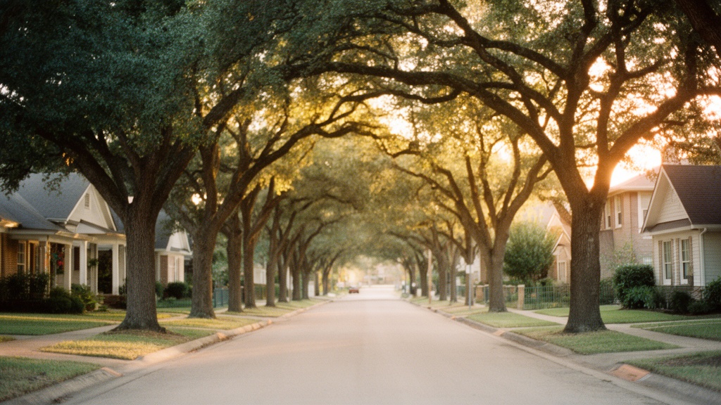
One thing worth noting about the older sections is the tree coverage. Streets lined with mature oaks and pecans create a canopy effect that newer subdivisions simply cannot replicate. That visual character is something buyers who have toured both older and newer DeSoto neighborhoods consistently mention.
Newer Build Subdivisions
Subdivisions built after 2000 in the southern and southeastern parts of DeSoto offer open-concept layouts, higher ceilings, and larger primary suites that reflect more recent buyer preferences. Floor plans in these areas commonly run from 2,200 to 3,800 square feet, and many homes include three-car garages and covered back patios. HOA fees in planned subdivisions typically range from $300 to $600 per year, covering common area maintenance and entrance landscaping.
The tradeoff with newer construction in DeSoto is that you are paying more per square foot and the lots, while larger in absolute terms than the city's older sections, are sometimes less private because the homes themselves are bigger relative to the lot. Understanding that balance is part of choosing the right neighborhood for your specific priorities.
You can find additional detail on what the current DeSoto market looks like for buyers in the article Homes for Sale in DeSoto, Texas: What Buyers Need to Know.
4. Commute Times, Amenities, and What Surrounds Each Neighborhood
Where a neighborhood sits within DeSoto has a direct effect on daily commute times and access to amenities. These are practical factors that do not always come through clearly in a listing description.
Getting to Dallas and the Surrounding Metroplex
From the northern sections of DeSoto near Belt Line Road, downtown Dallas is roughly 18 to 20 miles and typically 25 to 35 minutes by car during off-peak hours. During peak morning commute hours, that same drive can stretch to 40 to 50 minutes on US-67. From the southern sections near Wintergreen Road, add another 5 to 10 minutes to those estimates. Residents who prefer not to drive can use the DART bus routes that connect DeSoto to the light rail network, with the Hampton Road and Westmoreland stations being the most accessible transit hubs for the western side of the city.
For jobs in the medical district, Oak Cliff, or the Cedars area of Dallas, DeSoto's commute math works out particularly well. Those employment centers sit closer to the southern end of Dallas, cutting the actual drive distance for DeSoto residents compared to someone commuting from Frisco or McKinney.
Parks, Recreation, and Local Landmarks
DeSoto maintains several parks distributed across the city, with Grimes Park on Hampton Road serving as one of the larger municipal green spaces. The park includes athletic fields, a community center, and open lawn areas. Thorntree Country Club, a private golf facility, sits in the central part of the city and adds a distinctive landmark to that area. The DeSoto Aquatic Center on Westmoreland Road draws residents from across the city during the summer months.
For grocery and retail needs, the Pleasant Run Road corridor handles most of the city's commercial activity. A Walmart Supercenter, multiple grocery options, and a range of restaurants are concentrated in that stretch. The DeSoto Town Center area near Polk Street adds additional retail. Residents in the southern sections of the city also have easy access to the Cedar Hill retail corridor along US-67, which includes a Home Depot, Target, and additional dining.
For a broader look at community resources across DeSoto, the DeSoto TX Community and Neighborhood Guide provides a useful overview of local amenities and services.
5. What to Research Before You Choose a Neighborhood in DeSoto
Knowing the physical layout of DeSoto's neighborhoods is the starting point, but there are a few additional topics every buyer should investigate independently before making a decision.
Schools and Education Resources
Most of DeSoto falls within the DeSoto Independent School District, which operates elementary, middle, and high school campuses serving the city. School assignments are based on address, so the specific campus your household would be zoned to depends on which neighborhood and street you choose. The Texas Education Agency publishes campus-level accountability data at tea.texas.gov, which is the appropriate place to review performance information for any specific campus. That research is a personal decision that every buyer should conduct directly rather than relying on secondhand summaries.
Private school options exist in the broader southern Dallas County area as well, and the DeSoto ISD website at desotoisd.org publishes boundary maps that let you confirm campus assignments by address before you make an offer.
Doing Your Own Due Diligence
Beyond schools, buyers relocating to DeSoto should review municipal data directly from the City of DeSoto at desototexas.gov for information on code enforcement, planned infrastructure projects, and utility service areas. The Dallas County Appraisal District website provides property tax history and assessed values for any specific address, which matters when you are comparing homes in different parts of the city. Flood zone status is another important check: some properties near Ten Mile Creek and its tributaries carry FEMA flood zone designations that affect insurance costs, and the FEMA Flood Map Service Center at msc.fema.gov lets you verify any address.
The City of DeSoto also maintains a parks and recreation department that publishes an updated schedule of programs and facility hours, which gives you a practical sense of what community resources look like on the ground. Driving each neighborhood at different times of day, including a weekday morning and a weekend afternoon, remains one of the most reliable ways to understand what daily life in that part of DeSoto actually looks like.
If you are weighing your options and want to understand what the buying process looks like in DeSoto, the article Selling a Home in DeSoto, Texas: Pricing, Timeline and What to Expect also covers how sellers in each part of the city approach pricing, which is useful context for buyers making competitive offers.
For additional background on DeSoto as a city, including infrastructure, demographics, and community resources, the DeSoto, TX City Guide on Homes.com provides a useful reference point.
FAQ
What are the most established neighborhoods in DeSoto, Texas?
The most established residential areas in DeSoto are concentrated in the northern and western sections of the city, particularly along and near Hampton Road and the Cockrell Hill Road corridor. These areas contain homes built primarily between the late 1960s and the mid 1980s, with mature tree coverage, brick construction, and lot sizes typically between 7,000 and 11,000 square feet. List prices in these sections currently range from the low $200,000s to the upper $260,000s depending on the condition of the home and any updates that have been made. Buyers looking for established streetscapes and larger trees tend to gravitate toward these parts of the city.
Which parts of DeSoto, Texas have the newest homes?
The newest residential construction in DeSoto is concentrated in the southern and southeastern sections of the city, particularly near Wintergreen Road and Parkerville Road. Subdivisions in these areas were developed primarily from the mid 1990s through the 2020s, with homes offering open-concept layouts, higher ceilings, and larger primary suites. Floor plans commonly run from 2,200 to over 4,000 square feet, and lots are frequently a quarter acre or larger. As of September 2026, list prices in these newer sections range from the low $290,000s to just above $500,000 for the largest estate-style properties.
How long does it take to commute from DeSoto, Texas to downtown Dallas?
From the northern sections of DeSoto near Belt Line Road, downtown Dallas is roughly 18 to 20 miles and typically takes 25 to 35 minutes by car during off-peak hours. During morning peak commute periods, the same drive on US-67 can stretch to 40 to 50 minutes. Residents in the southern sections near Wintergreen Road should add approximately 5 to 10 minutes to those estimates. DART bus routes connect DeSoto to the light rail network, with the Hampton Road and Westmoreland stations being the most accessible transit options for the western side of the city, providing a car-free alternative for commuters headed into Dallas.