
← Back to Blog
Neighborhoods
Southwest Ocala vs. Northeast Ocala: What Is the Difference in Amenities and Daily Life?
By Cameron Cowart
Dalton Wade
September 24, 2026 · 12 min read
If you are trying to decide between southwest Ocala and northeast Ocala, the difference between living in southwest Ocala versus northeast Ocala in terms of amenities and daily life is more significant than many people expect. These two corridors of the same city have distinct housing stock, retail landscapes, commute patterns, and overall rhythms. This guide breaks down what you will actually encounter day to day in each area so you can make a well-informed decision before you buy.
1. The Geographic Layout: How Each Corridor Is Positioned
Southwest Ocala and northeast Ocala sit on opposite ends of the city, and each one has developed its own character over the past three decades. Understanding the physical layout of each corridor is the first step toward understanding what your daily life would actually look like there.
Southwest Ocala: SR 200 and the College Road Corridor
Southwest Ocala is anchored by State Road 200, which runs from the city's western edge toward I-75. This corridor has seen the most concentrated commercial and residential development in Marion County over the past 20 years. College Road (SW 17th Street) serves as a secondary spine, connecting neighborhoods to the SR 200 retail belt and to the College of Central Florida campus. The area borders Alachua County to the north and is within a short drive of I-75, which gives it strong connectivity to Gainesville (about 38 miles north) and Tampa (about 85 miles south).
Northeast Ocala: US 301 and the Silver Springs Corridor
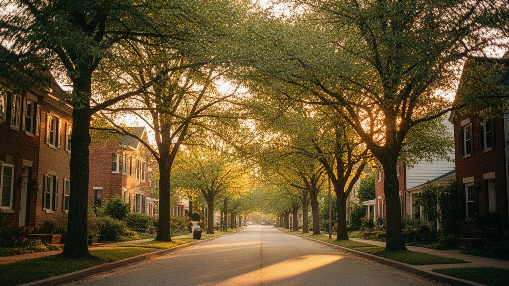
Northeast Ocala is shaped by US 301 (NE 25th Avenue) and SR 40, which heads east toward Silver Springs State Park and the Ocala National Forest. This part of the city is older in character and has a more established, tree-lined feel in many of its residential pockets. The northeast quadrant borders the Ocala National Forest, the largest sand pine scrub forest in the world, which begins roughly 10 to 12 miles east of downtown. Belleview and Silver Springs Shores are nearby communities that many northeast Ocala residents interact with regularly.
2. Housing Stock and Price Ranges in Each Area
The housing stock in southwest Ocala and northeast Ocala is meaningfully different in age, style, and price point. Both areas offer options across a range of budgets, but the mix of new construction versus existing homes, and the lot sizes and community amenities that come with them, vary considerably.
What You Find in Southwest Ocala
Southwest Ocala contains the largest concentration of newer planned communities in Marion County. Neighborhoods like Heath Brook, Fore Ranch, and the communities along SW 80th Street were built primarily between 2000 and the present. You will find a lot of block construction homes with tile roofs, two-car garages, and HOA-managed common areas. Entry-level homes in this corridor start around $230,000 to $260,000 for smaller three-bedroom models, while larger four and five-bedroom homes in gated subdivisions can reach $450,000 to $600,000 or more. New construction is still active here in September 2026, with several builders offering move-in-ready inventory.
Lot sizes in southwest Ocala tend to run smaller than in the northeast, typically between 6,000 and 10,000 square feet for standard subdivision lots. If you want acreage in the southwest corridor, you generally need to move further out toward Dunnellon or into the SR 484 area. For buyers interested in new construction specifically, the article on new housing developments being built in Ocala in 2026 covers the active projects in detail.
What You Find in Northeast Ocala
Northeast Ocala has a broader mix of housing eras, from mid-century concrete block homes built in the 1960s and 1970s to more recent subdivisions developed in the 1990s and 2000s. You will find more variety in architectural style here: ranch homes on quarter-acre lots, split-level layouts, and older brick homes with mature oak canopies. Price points in northeast Ocala tend to run somewhat lower on average than in the southwest corridor, with many three-bedroom homes available in the $180,000 to $300,000 range, though updated or larger properties can exceed that.
Lot sizes in the northeast are generally more generous in the older subdivisions, and rural-edge properties on one to five acres are more accessible without driving as far out of the city. Silver Springs Shores, just southeast of downtown and accessible from the northeast corridor, has a large stock of affordable concrete block homes on standard lots, many in the $160,000 to $240,000 range as of September 2026.
3. Retail, Dining, and Everyday Errands
One of the most practical differences between living in southwest Ocala versus northeast Ocala is how convenient your daily errands will be. Grocery runs, pharmacy stops, and restaurant choices vary significantly depending on which side of the city you are on.
Shopping and Services in Southwest Ocala
Southwest Ocala has the densest concentration of retail in all of Marion County. The SR 200 corridor contains Paddock Mall (the only enclosed regional mall in Ocala), multiple Publix and Winn-Dixie locations, a Costco, a Sam's Club, Target, Home Depot, Lowe's, and dozens of national restaurant chains. Within a five-mile stretch of SR 200 between I-75 and Pine Avenue, you can handle virtually every errand without leaving the corridor. Medical facilities are also concentrated here: HCA Florida Ocala Hospital and AdventHealth Ocala are both accessible from this part of the city.
The dining scene in southwest Ocala skews heavily toward chain restaurants, though local spots do exist along College Road and in smaller strip centers off SR 200. If convenience and one-stop shopping are priorities, southwest Ocala is hard to beat within the Ocala market. Most residents in this corridor can reach a grocery store in under 10 minutes from their front door.
Shopping and Services in Northeast Ocala
Northeast Ocala has a more dispersed retail landscape. There are grocery options along NE 25th Avenue and near the Silver Springs Boulevard corridor, including Publix and Winn-Dixie locations, but the overall density of retail is lower than in the southwest. For big-box shopping, most northeast Ocala residents drive toward downtown or cross to the SW 200 corridor, which can add 15 to 25 minutes to a shopping trip depending on where you live.
Where northeast Ocala stands out is in its proximity to older, locally owned businesses and the historic downtown Ocala square. Downtown Ocala, located just west of the northeast quadrant, has a growing dining and entertainment scene centered around the Ocala Downtown Square. Farmers markets, local breweries, and independent restaurants are within a short drive for northeast residents in a way that southwest residents typically are not. The Marion County Tax Collector, the courthouse, and many county government offices are also closer for northeast residents.
4. Parks, Recreation, and Natural Amenities
Both sides of Ocala offer outdoor recreation, but the type and scale of what is available differs considerably between the southwest and northeast corridors.
Outdoor Life in Southwest Ocala
Southwest Ocala is home to several community parks and recreational facilities managed by the City of Ocala and Marion County. Tuscawilla Park, while technically near downtown, is accessible from the southwest side. The SW area also has proximity to the Cross Florida Greenway (Marjorie Harris Carr Cross Florida Greenway), a 110-mile multi-use trail corridor that runs through Marion County and offers hiking, equestrian trails, mountain biking, and paddling access. The Greenway's Pruitt Trailhead on SW 16th Avenue is a popular access point for southwest residents.
Many of the planned communities in southwest Ocala include their own amenity centers with pools, fitness rooms, and walking trails within the subdivision. Fore Ranch, for example, has a community clubhouse and pool. The World Equestrian Center, which opened in 2021 and hosts major equestrian competitions year-round, is located about 10 miles northwest of the SW 200 corridor and is easily reached from the southwest side of the city.
Outdoor Life in Northeast Ocala
Northeast Ocala's most significant natural asset is its proximity to Silver Springs State Park and the Ocala National Forest. Silver Springs State Park, located on SR 40 about 7 miles east of downtown, is one of Florida's oldest natural landmarks. The park features glass-bottom boat tours over the Silver Springs headspring, kayaking on the Silver River, hiking trails, and wildlife viewing. The spring system produces roughly 550 million gallons of water per day and maintains a constant 72-degree temperature year-round.
The Ocala National Forest, accessible via SR 40 east of Silver Springs, covers more than 600 square miles and offers camping, off-road vehicle trails, freshwater springs including Juniper Springs and Alexander Springs, and fishing in dozens of lakes. For residents who prioritize access to large-scale natural areas over manicured subdivision amenities, the northeast side of Ocala provides something the southwest simply cannot replicate. You can be at the entrance to the National Forest in under 20 minutes from most northeast Ocala addresses.
Lake Weir, a 5,685-acre freshwater lake in southern Marion County, is also more accessible from the northeast and southeast sides of Ocala than from the southwest. If lakefront living interests you, the guide on buying lakefront or waterfront property in Ocala covers the specific lakes and considerations in detail.
5. Commute Patterns and Getting Around
Where you work will have a large influence on which part of Ocala makes more practical sense for your daily routine. The commute experience in southwest Ocala versus northeast Ocala is quite different, both within the city and for trips to surrounding areas.
Driving in Southwest Ocala
Southwest Ocala has direct access to I-75 via multiple interchanges at SR 200 and SW 38th Avenue. This makes it the stronger choice for anyone who commutes south toward The Villages (about 25 miles), Gainesville (about 38 miles north on I-75), or Tampa (roughly 85 miles south). The SR 200 corridor itself does experience traffic congestion during morning and evening peak hours, particularly between Pine Avenue and I-75, but most internal trips within southwest Ocala remain under 15 minutes.
For those commuting to Orlando, both sides of Ocala involve a similar total distance of about 80 to 85 miles, but southwest residents typically access the Florida Turnpike via SR 200 west to US 27, while northeast residents may use US 441 south or cut across to I-75. The full breakdown of the Ocala-to-Orlando commute is covered in the guide on commuting from Ocala to Orlando for work.
Driving in Northeast Ocala
Northeast Ocala connects most naturally to US 301 and SR 40, which are two-lane and four-lane state roads rather than limited-access highways. Getting to I-75 from the northeast side of Ocala requires cutting across the city, which typically adds 15 to 20 minutes to any interstate-dependent commute. However, northeast residents are closer to downtown Ocala, the Marion County government complex, and the hospital district along NE 25th Avenue. If your workplace is in or near downtown Ocala, the northeast side can actually reduce your daily drive time compared to the southwest.
Traffic in the northeast is generally lighter than on SR 200, though SR 40 east of downtown can back up near the Silver Springs Boulevard intersection during peak hours. Northeast residents heading to Gainesville often use US 441 north rather than I-75, which adds roughly 10 to 15 minutes to that trip but avoids the SR 200 traffic entirely.
6. Schools, Healthcare, and Practical Services
School zones and healthcare access are two factors that many buyers research carefully before choosing a side of the city. Both southwest and northeast Ocala fall within the Marion County Public Schools district, which serves the entire county. Because school assignments depend on your specific address rather than your general quadrant, you should verify the exact zone for any home you are considering directly through the Marion County Public Schools district website. For a step-by-step approach to researching school zones during a home search, the guide on researching public school zones in Ocala walks through the process.
For healthcare, both HCA Florida Ocala Hospital and AdventHealth Ocala are located closer to the southwest and central parts of the city. Northeast residents are not far from either facility, but the drive from the northeast side typically runs 10 to 20 minutes longer than from the southwest corridor. Specialist clinics, urgent care centers, and outpatient facilities are more heavily concentrated along SR 200 and the SW 17th Street corridor. The College of Central Florida, located on SW 80th Street in the southwest quadrant, is the primary community college serving Marion County and is most accessible from the southwest side.
For a broader look at the Ocala neighborhoods landscape and how these two corridors fit into the larger Marion County picture, Sloan Properties' Marion County neighborhood guide provides useful context on how the different parts of the county are organized geographically.
7. Putting It Together: A Side-by-Side Summary
The difference between living in southwest Ocala versus northeast Ocala in terms of amenities and daily life comes down to a few consistent patterns. Here is a direct comparison of the key factors:
- Housing age and style: Southwest Ocala is dominated by newer construction from 2000 to present, with planned communities, HOAs, and block homes. Northeast Ocala has a broader mix of eras, including mid-century and 1980s to 1990s homes on larger lots.
- Price range: Southwest Ocala entry-level homes start around $230,000 to $260,000, with upper-end subdivisions reaching $450,000 to $600,000 or more. Northeast Ocala has more options in the $160,000 to $300,000 range as of September 2026.
- Retail and services: Southwest Ocala has the highest concentration of retail, grocery, and medical services in the city. Northeast Ocala has fewer big-box options but is closer to downtown Ocala's local dining and government services.
- Natural recreation: Northeast Ocala is within 20 minutes of Silver Springs State Park and the Ocala National Forest. Southwest Ocala is closer to the Cross Florida Greenway and the World Equestrian Center.
- Interstate access: Southwest Ocala has direct I-75 access, making it more practical for commuters heading to Gainesville, Tampa, or The Villages. Northeast Ocala relies on US 301 and SR 40 and involves a longer drive to reach the interstate.
- Downtown proximity: Northeast Ocala is closer to the historic downtown Ocala square, local restaurants, and county government offices. Southwest Ocala is further from downtown but surrounded by its own commercial corridor.
- New construction activity: Southwest Ocala has the most active new construction pipeline in September 2026. Northeast Ocala has limited new construction and is primarily a resale market.
Neither corridor is objectively better than the other. The right choice depends on your work location, your priorities around retail convenience versus natural access, your budget, and the type of home you want to live in. If you are relocating from out of state and want a broader orientation to how Ocala's different areas compare, the guide on relocating to Ocala from out of state covers the full picture.
FAQ
Is southwest Ocala more expensive to live in than northeast Ocala?
Generally, yes, though the gap depends on the specific property. Southwest Ocala's newer planned communities and active new construction market push median prices higher, with many homes in the $280,000 to $450,000 range in September 2026. Northeast Ocala has more inventory in the $160,000 to $300,000 range, particularly in older subdivisions and Silver Springs Shores. That said, both corridors have outliers in both directions, and the specific home, lot size, and condition matter more than the quadrant alone. Working with a local agent who knows both sides of the city will help you find the best value for your specific needs.
Which part of Ocala is closer to Silver Springs State Park?
Northeast Ocala is significantly closer to Silver Springs State Park. The park entrance on SR 40 is approximately 7 miles east of downtown Ocala, which puts it within 15 to 20 minutes of most northeast Ocala addresses. From the southwest side of the city, the same trip typically takes 30 to 40 minutes depending on where you start. If regular access to Silver Springs, the Silver River, or the Ocala National Forest is a priority, the northeast corridor offers a clear geographic advantage for that specific use.
Can I find a home with acreage in both southwest and northeast Ocala?
Acreage properties exist in both corridors, but they are more accessible in and around northeast Ocala without driving as far from the city core. The northeast and east sides of Marion County have more rural-edge properties on one to five acres within 10 to 15 miles of downtown. In the southwest corridor, larger lots become more common as you move toward Dunnellon or the SR 484 area, which is further out. If land and rural character are priorities, it is worth expanding your search to include the broader northeast and east Marion County area, and a local agent can help you identify where the acreage inventory is concentrated right now.